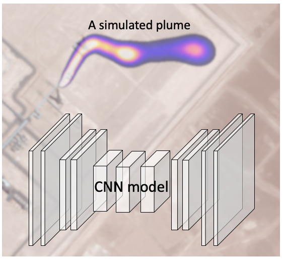
A convolutional neural network (CNN) model was built to predict trace-gas concentration from remote sensing images for the first time.
A remote sensing system with multi-spectral or hyper-spectral capabilities can be used to identify materials and their compositions on the ground from a few miles (airplanes) to hundreds of miles (satellites) away in the sky. It could be also used to detect trace gas (such as methane, an important greenhouse gas) near the ground if condition is right.
Such detection relies on the individual spectrum for each pixel in the multi- or hyper- spectral remote sensing image. Trace gas like methane has a signature absorption spectrum that sometimes can be identified from remote-sensing spectra. As a result, the methane concentration could be obtained for each single-pixel spectrum, and an image of methane concentration can be derived accordingly. This is the pixel-wise approach. However, the result of this pixel-wise approach can be quite noisy and has very large error bars due to various reasons such as low reflectivity of some ground covers, and fluctuation in detector sensitivity.
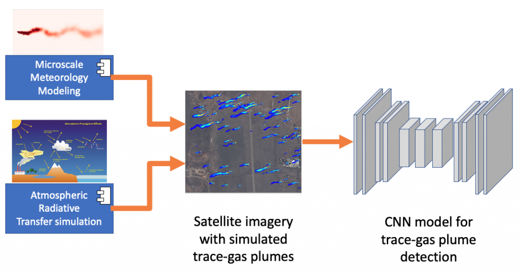
A CNN model can be used to mitigate some of these problems by combining information from neighboring pixels. However, to train such a model, a large amount of data needs to be available for the supervised learning, while remote sensing data with ground truth of trace gas concentration is scarce and it is very expensive to acquire large amount of training data.
To overcome the data problem, we combined micro-scale meteorology modeling and atmospheric radiative transfer simulation to obtain synthetic satellite images. This allows us to build sufficient amount of training, validation, and testing images for our CNN model which helps facilitate methane detection. This novel, CNN-based method improves greatly the robustness of methane detection, compared to the traditional pixel-wise approach.
This is a satelytics project.


